 Book now
 The underground river canyon of Škocjan
The story of the Reka river, the vast canyon it carved, and the Cerkvenik bridge — what makes Škocjan a UNESCO wonder.
The Škocjan Caves owe everything to a river that vanishes underground. Here's the story of the Reka, the canyon it carved, and the bridge that lets you cross it.
The river that disappears
The Reka river rises in the hills of south-west Slovenia and flows on the surface until, at Škocjan, it meets the limestone of the Karst and simply vanishes underground. Over hundreds of thousands of years it has dissolved and carved its way through the rock, hollowing out the immense canyon at the heart of the caves.
It re-emerges only in Italy, near the Adriatic, as the Timavo — a classic example of the 'disappearing rivers' that gave the Karst its name and lent the word 'karst' to geology worldwide.
One of the world's great underground canyons
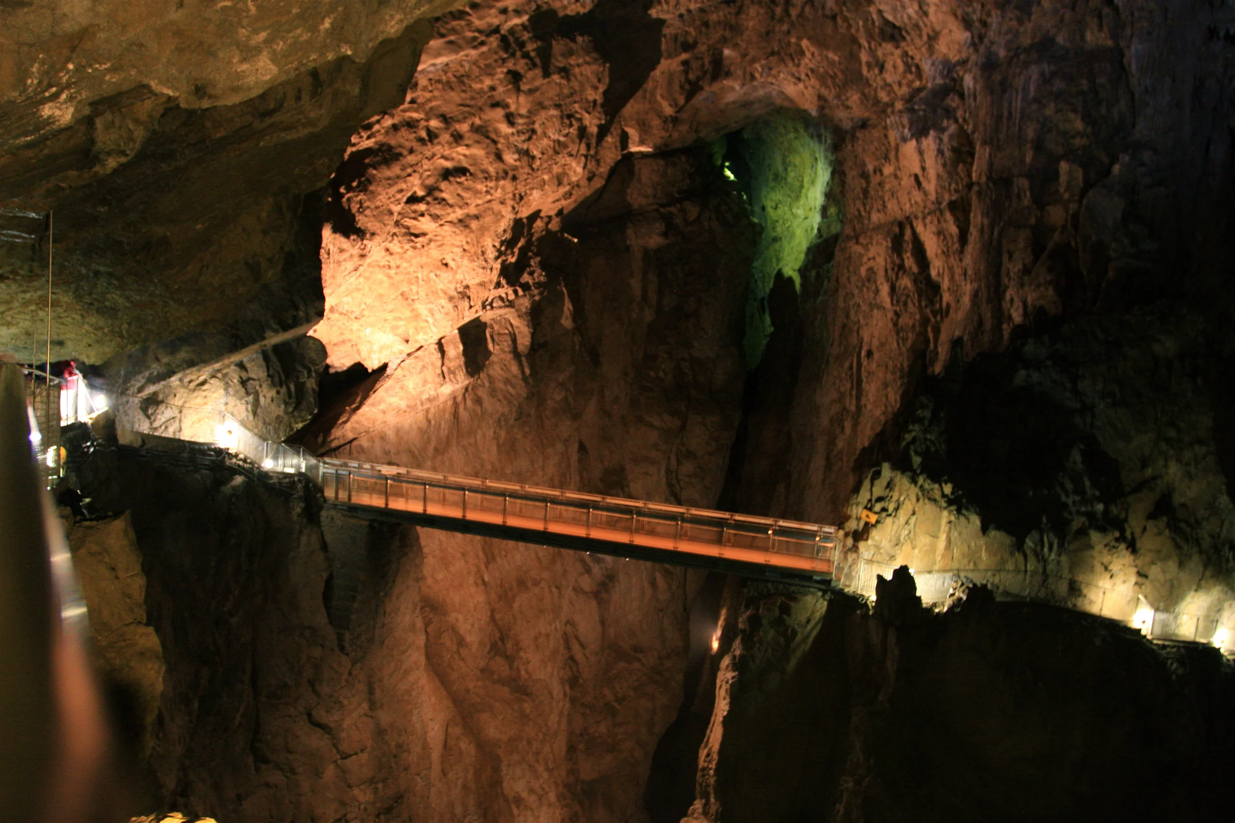
The canyon the Reka has cut is among the largest known underground gorges on Earth — up to 146 metres deep and, in places, 60 metres wide, with the river thundering along its floor. The chambers are so vast that the sound of the water fills the darkness long before you see it.
It was this scale, and the underground wetland ecosystem that depends on the river, that earned Škocjan its place on the UNESCO World Heritage list in 1986.
The Cerkvenik bridge
To let visitors cross the canyon, a footbridge — named after the Cerkvenik family of local guides who helped explore the caves — was built high above the river, around 45 metres up. Crossing it, with the Reka roaring below and the canyon walls rising into darkness, is the defining moment of the Škocjan tour.
It is the image most associated with the caves, and one of the most dramatic walkways in any show cave in the world.
Explorers and early tourism
People have known the Škocjan abyss since antiquity — it appears on maps and in accounts for centuries — but systematic exploration came in the 19th century, when local guides and cavers pushed deep into the canyon and the first paths and bridges were built. Tourism followed, and the caves have welcomed visitors for well over a century.
That long history of guiding is why the tour today is so assured, and why the bridges bear the names of the families who built them.
A living, protected landscape
Škocjan is more than a cave: it's a regional park and a protected wetland of international importance, home to a specialised underground ecosystem and a karst landscape of collapse dolines, sinkholes and the surface course of the Reka. The park works to conserve all of it.
Visiting on a guided tour, without photography inside, is part of keeping this fragile, extraordinary place intact for the future.
Frequently asked
Why does the Reka river go underground at Škocjan?
The river meets soluble limestone at Škocjan and sinks into it, carving the underground canyon over millennia; it re-emerges in Italy as the Timavo.
How big is the underground canyon?
Up to about 146 metres deep and 60 metres wide in places — one of the largest known underground river canyons in the world.
What is the Cerkvenik bridge?
A footbridge about 45 metres above the Reka, named after a local family of cave guides, that lets visitors cross the canyon — the highlight of the tour.
Why is Škocjan a UNESCO site?
For the exceptional scale of its underground canyon and the important underground wetland ecosystem, inscribed in 1986.
Is 'karst' named after this region?
Yes — the Slovenian/Italian Karst gave its name to karst landforms worldwide, of which Škocjan is a spectacular example.